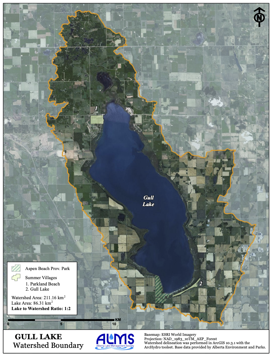
Our Society was formed in 1998 to assist with sampling of the lake in partnership with Alberta Environment. We continue to be active in sampling and this year assisted or carried out series of samplings of the lake water and two of the Blindman Diversion.
The Society endeavors to maintain membership from all areas of the lake and maintain a board of directors that has members from every significant area. At present, we have active members from Parkland Beach, Sunnyside, Birch Bay, Summer Village of Gull Lake, Wilsons Beach, the surrounding agricultural Community, and Meridian Beach. There were 28 members at our last annual meeting held at the Summer Village of Gull Lake in September of 2022.
“Our mission is to contribute to the preservation of Gull Lake and the area within its watershed as a continuing desirable recreation area and to assist in protecting the water quality of the lake in cooperation with residents of the watershed.”
Gull Lake water levels continue to fall and an environmental group is lobbying the province to restart a pumping program to pull water from Blindman River
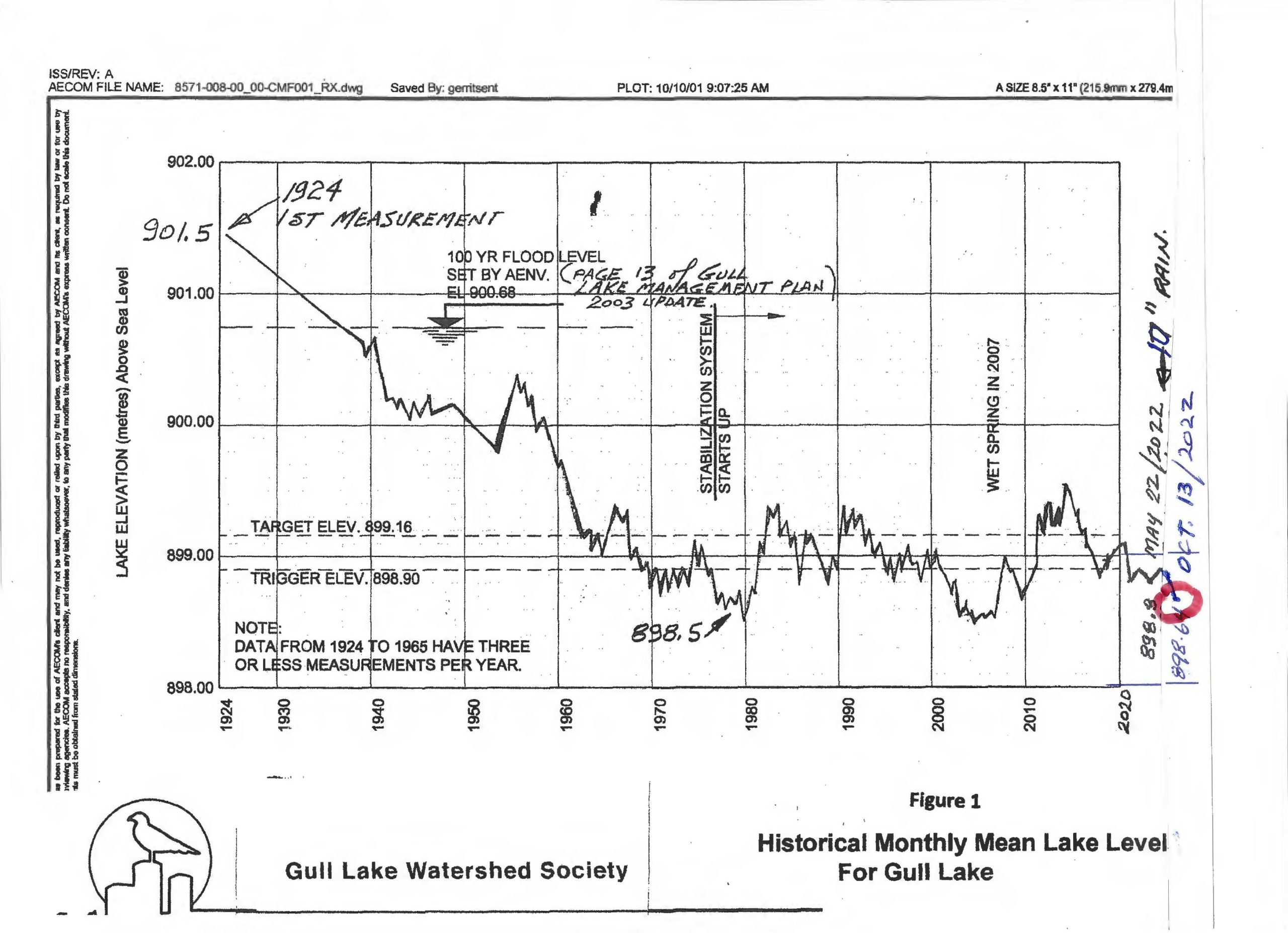
The Gull Lake water stabilization system was built in the 1970s to help maintain water levels in the lake that had fallen 2.6 metres between 1924 and 1976. For more than 40 years when water levels fell below a certain threshold pumps drew water from Blindman River into the lake.
However, the discovery of the invasive Prussian carp in the river in 2018 brought a halt to the practice for fear of contaminating the lake with the fish.
Gull Lake Watershed Society members, which include engineers and biologists, went to work to find ways to filter out the carp and their tiny eggs from river water before it is pumped into the lake, said society director Craig MacLeod on Monday.
After testing different technologies a filtration system was developed and tested successfully. Stantec engineering consultants reviewed the findings and verified the filter system was 100 percent successful in catching carp eggs before they could reach the lake, said Stantec estimated the cost of installing a full-size filtration system at $400,000 and recommended other upgrades to the pumping system to improve efficiency.
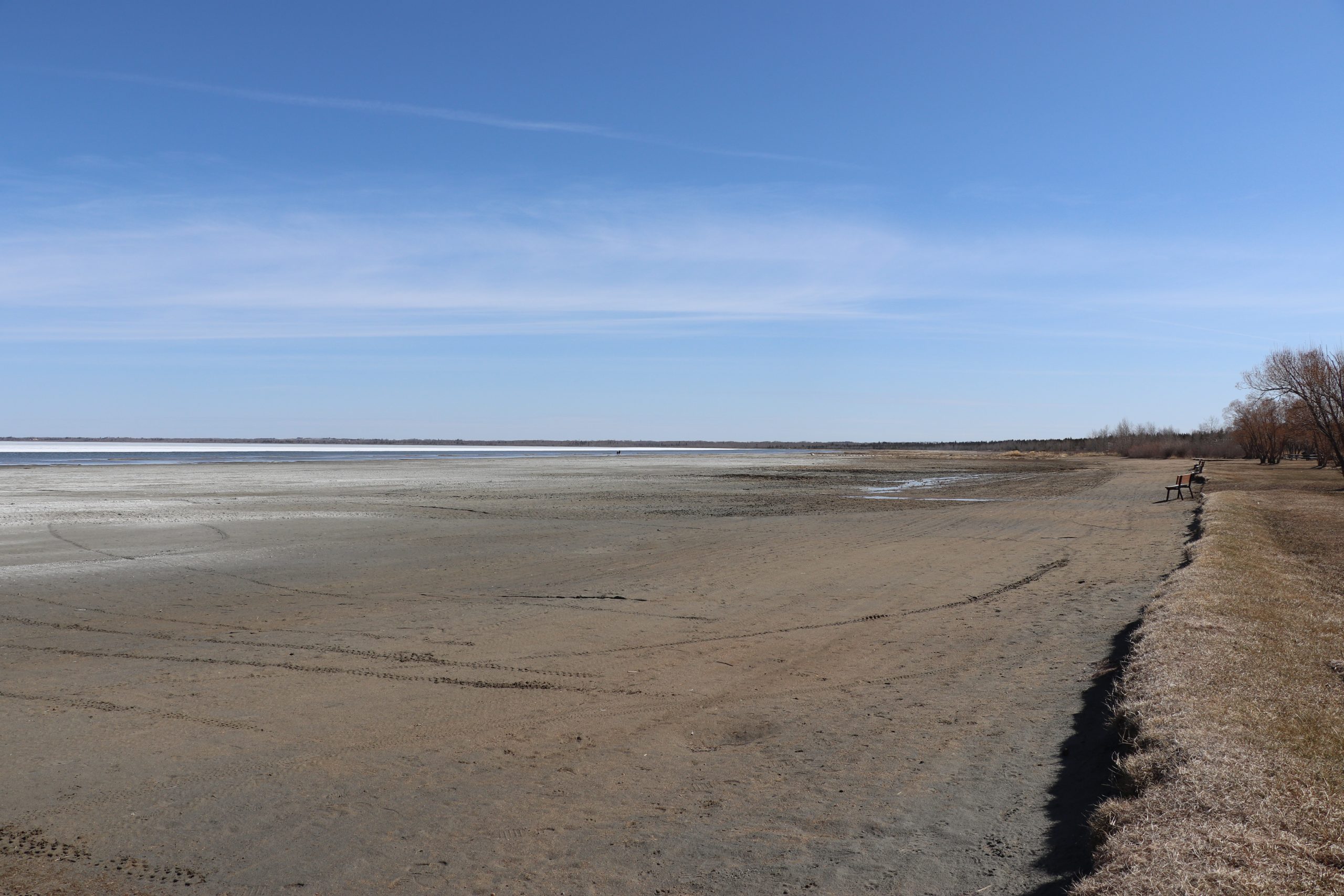
Photography by Jeremy Crawford from APPKITT
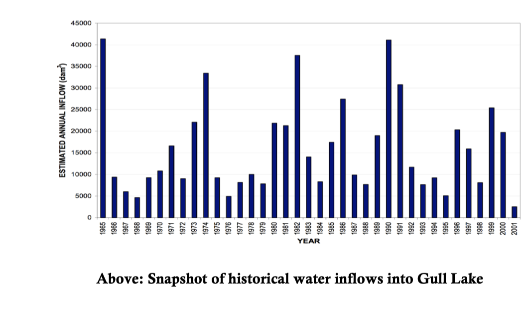
A resumption of pumping is badly needed, said MacLeod. In the last few years, water levels have fallen another 60 cm, which has extended the shoreline so far out into the lake that most private boat launches can no longer be used.
“It’s very difficult and dangerous to launch these bigger boats,” said MacLeod.
Low water levels are also threatening one of central Alberta’s most popular recreation lakes that is ringed by campgrounds, numerous cottages and attracts tens of thousands of visitors every summer.
Lacombe and Ponoka Counties and many others who appreciate what the lake brings to central Alberta have been supportive of the society’s efforts to bring lake stabilization back, he said.
The society went before Lacombe County council last week to enlist support in its efforts to lobby Alberta Environment and Protected Places to provide the green light and funding to restart the pumping program this summer. Letters have been sent to local MLAs, Environment and Protected Areas Minister Sonya Savage and Forestry, Parks and Tourism Minister Todd Loewen calling for action.
Article by Paul Cowley . Published by the Red Deer Advocate on January 30, 2023

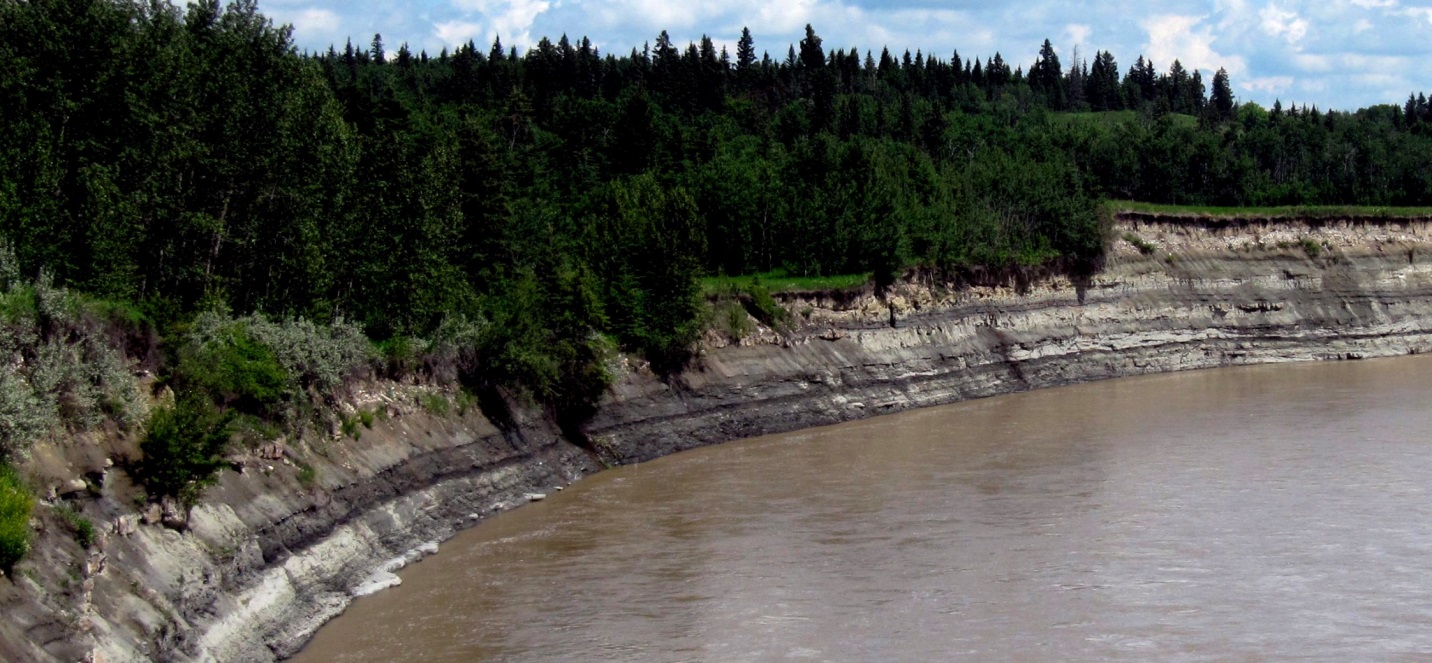
The Haynes aquifer is a regionally extensive body of sand that lies in the bottom part of the Paskapoo Formation. The isopach was created from the modelled results of the average sandiness of 25 m thick slices in boreholes completed within the Paskapoo Formation. Parts of the aquifer are as much as 100 m thick, particularly in the west near the deformation belt and in a region west of the city of Red Deer. The bulk of the unit averages about 50 m in thickness.
The Paskapoo formation is massive formation of approx. 66,000 km2, 80% of the area of Lake Superior.
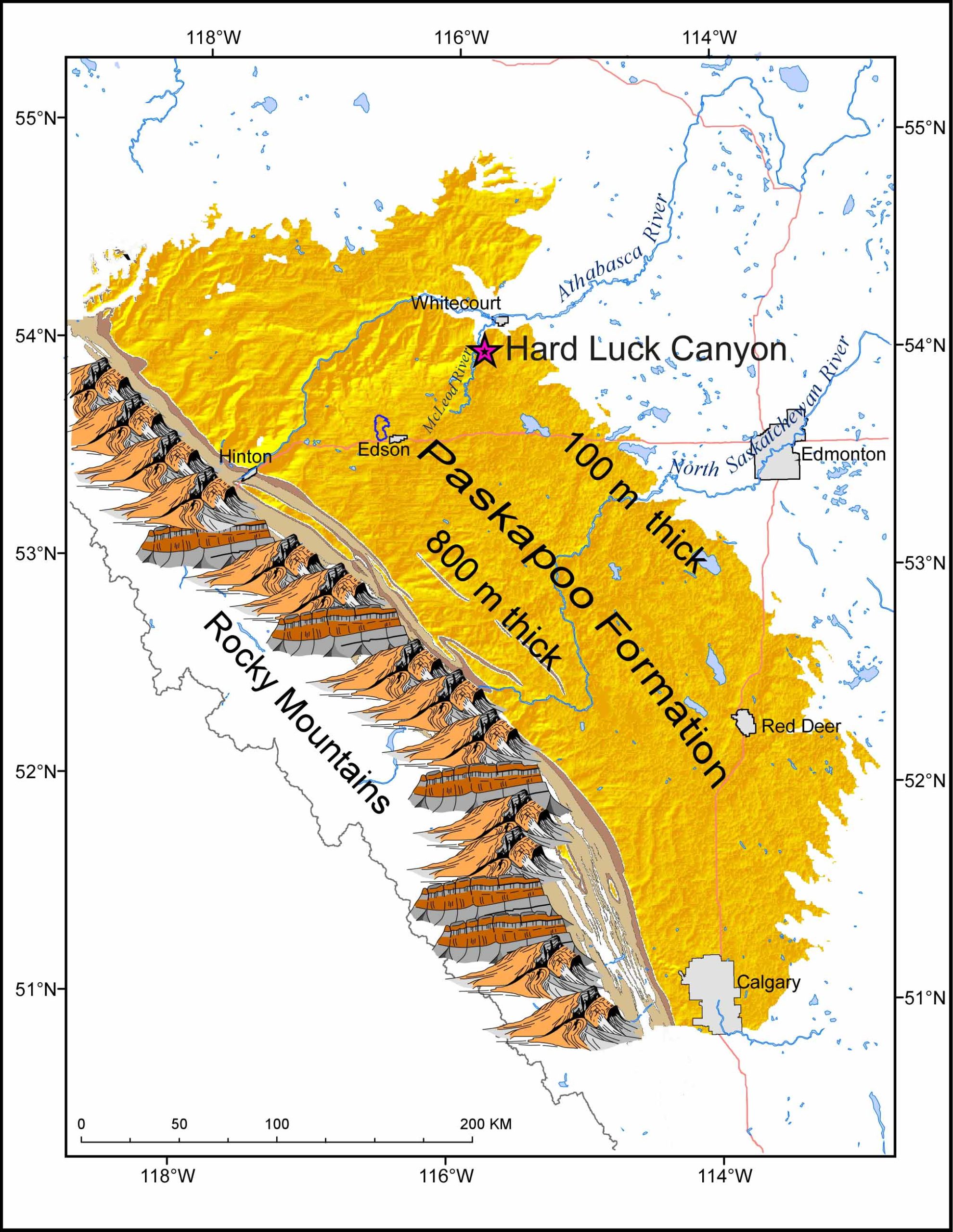
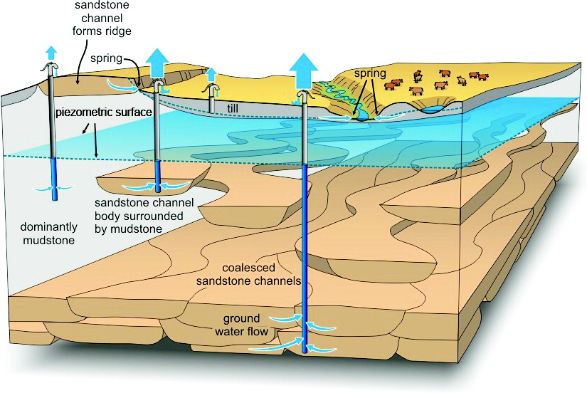

The Paskapoo Formation of southern Alberta supports more groundwater wells than any other aquifer system in the Canadian Prairies. Located in a region of rapid population growth and straddling watersheds where no new surface water licenses are available, this aquifer system is under increasing pressure to provide water supply.
The Paskapoo Formation represents a foreland deposit of a siltstone- and mudstone-dominated fluvial system. The system is highly heterogeneous with broad ranges in physical properties that impact groundwater production. High-porosity coarse-grained channel sandstone can provide productive wells, whereas thin and fractured sands and siltstones are low producers.
The basal Haynes Member and western portion of the Paskpaoo Formation have higher sandstone volumes than other portions of the system. Fracture density shows a strong inverse relationship to bed thickness, such that fracture flow becomes more important for thinner sandstone beds. There is no regional-scale flow system associated with the Paskapoo Formation; rather it is dominated by local-scale recharge processes. The geochemistry of Paskapoo Formation groundwater is largely controlled by the variable composition of immediately overlying glacial deposits
